Visualizing the Landscape of Early Baltimore
Slave Streets, Free Streets: Visualizing the Landscape of Early Baltimore builds on the BEARINGS of Baltimore by using the landscape as a story-telling medium. We bring Early Republic Baltimore to life by focusing on the city in which approximately 4,300 enslaved and 10,300 free African Americans lived and worked. Generous support from UMBC’s Office of Research Development during the academic year 2018-2019 made this initial phase of the project possible.
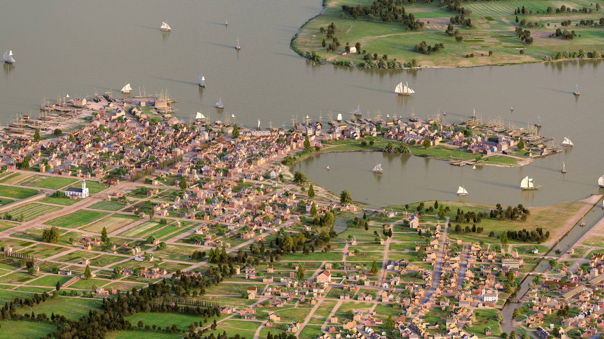
Baltimore, between 1815 and 1820, was a complicated, multi-faceted city. A bustling, thriving port, Baltimore represented the diversity of the early nation in a microcosm. Baltimore teemed with new immigrants from Europe and relocated country folk. Enslaved people worked alongside free blacks and whites in the city’s shipyards and construction sites. Baltimore merchants shipped more flour than any other American city, and the city’s wealth and banking interests helped to make it a British target during the War of 1812. Baltimoreans also had access to a wide range of imported luxury goods—wines and sherries, olive oil and coffee, silver, and textiles.
Baltimore was unusual among cities of the time in that its population of free blacks was twice that of the enslaved workers who toiled in the city. This was a direct consequence of both Maryland’s location on the literal border between slavery and freedom and the late-eighteenth-century shift by many Maryland farmers from tobacco to less labor-intensive cereal crops. As a result, slavery in Maryland was declining, although it was still a significant source of labor and profit. To both slow the rate of manumissions and prevent enslaved workers from running away, Marylanders adopted the institution of “term slavery,” where an enslaved person and his or her owner would agree that after a certain term of years or at a certain age, the enslaved person would be freed. This agreement was both legally binding and transferable. As a result, many African Americans in Baltimore lived in mixed families, with some members free and some enslaved.
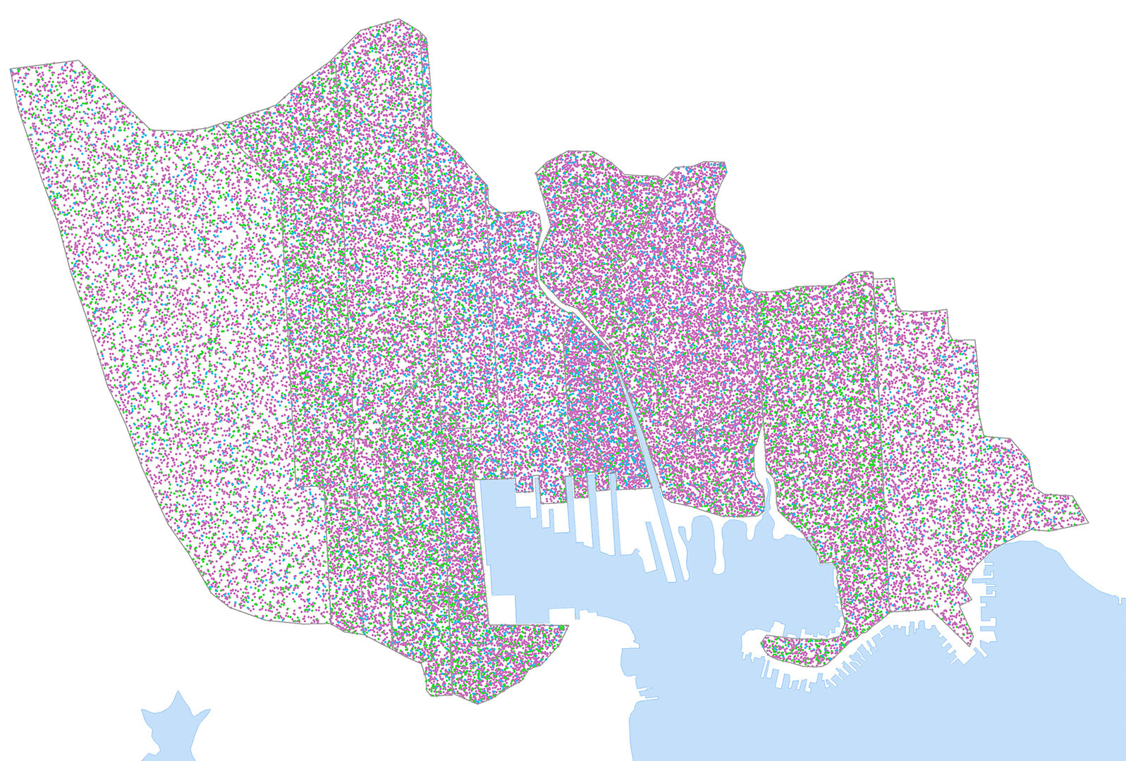
Our digital project investigates four interconnected themes: the lives of free blacks, the lives of enslaved workers, the sites and workings of the slave trade, and stories of fugitive slaves who ran both to and from Baltimore. Drawing on city directories, tax records, census reports, newspapers, and other historical documents, we are re-discovering people, including free and enslaved residents, at locations around the city and tying them by name to specific addresses. We are also identifying dozens of places where Baltimoreans were engaged in the slave trade and telling the stories of fugitives from slavery by drawing on runaway slave advertisements and slave narratives.
Sample Stories
Geography
Slave Streets, Free Streets in the News
BEARINGS of Baltimore, Circa 1815
- It looks like a video game, but it’s not. It’s a 3D map of the buildings, roads and land in 1815 Baltimore, created by UMBC
- This awesome 3D map visualizes Baltimore in 1815
- Dan Bailey, Imaging Research Center, on WYPR, Discusses “BEARINGS of Baltimore Circa 1815”
- Bearings Of Baltimore, Circa 1815 On Digital Display At Md. Historical Society
Slave Streets Free Streets
- Slave Streets, Free Streets: Visualizing the Landscape of Early Baltimore,” Current Research in Digital History (October 2021)
- Accuracy and Authenticity in a Digital City: Slave Streets, Free Streets and the Landscape of Early Baltimore,” AHA Perspectives (November 2020)
- Historian explores legacy of slavery in Baltimore
Researchers and Creators
Project Directors: Anne Sarah Rubin, Professor of History and Associate Director, Imaging Research Center, UMBC, and Dan Bailey, Professor of Visual Arts, UMBC
Programming: Mark Jarzynski, IRC Technical Director
Modeling: Ryan Zuber, IRC Technical Director
Geographic Information Systems Specialist: Lindsay Previtt
Historical Research: Kaiia Heck Coleman and Alex Sievers
2D and 3D Content Creation Assistants: Ata Chaudhry, Ebony McKay, Natalia Mitiuriev, Mario Moya, Emma O’Donnell, Teng Yang
Funding
Office of Research Development, University of Maryland, Baltimore County
Acknowledgments: Lee Boot, Rachel Brubaker, Mary Ellen Hayward, Ed Papenfuse, Marsha Velli
Bibliography: Primary and Secondary Sources
Imaging Research Center, UMBC © 2024