Reconstructing the Historical Geography of a Postindustrial Community

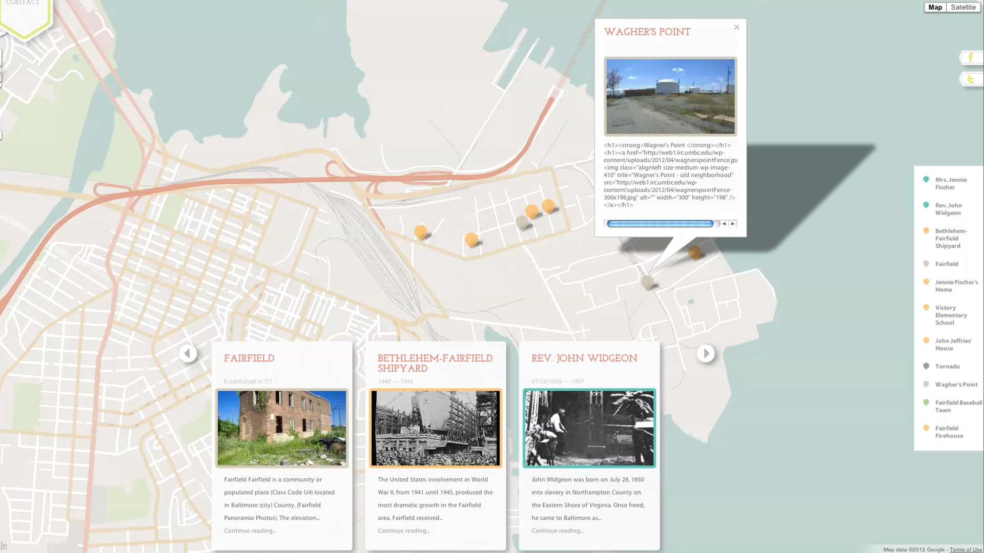
Mapping Baybrook is a collaborative and interdisciplinary web-based exploration of place. It uses digital mapping to illustrate research on the history and culture of Baybrook, an industrial community in Baltimore, Maryland. The project, launched in 2011 was at the vanguard of the practice of digital, online, interactive mapping of people, places, and things that have since proliferated and become something of a norm, especially for historical and cultural work.
The name Baybrook is a merging of the names of two adjacent neighborhoods, Curtis Bay and Brooklyn. This community is a mix of diverse but connected neighborhoods located along the southeast coastline of Baltimore City. The Greater Baybrook area includes the past and present neighborhoods of Brooklyn, Curtis Bay, Fairfield, Hawkin’s Point, Masonville, and Wagner’s Point. The story of Greater Baybrook reflects the tenacity of a community striving for sustainability in the boom-and-bust cycle of U.S. industrial development.
The project was initiated by UMBC professors Steve Bradley of Visual Arts and Dr. Nicole King of American Studies who are both deeply interested in issues of place, community, and culture.
The goal of Mapping Baybrook was to document and preserve the history, culture, identity, sense of place, and memories of the Baybrook areas and its residents both past and present through a dynamic and interactive online and mobile environment. As such, part of the process involved building a custom framework, database, and visual schematic that can archive, organize, and cross-reference the research content dynamically. The content was then displayed aesthetically and interactively with a user interface that was integrated with Google Maps.
The IRC continued to develop the website and database, allowing the entry of text, audio, images, and video. This information has been geo-located on a map, chronicled in time, and interconnected with other uploaded data. The site has been populated with over 50 nodes of detailed data points, including multi-media posts, interviews, audio clips, and historical content. Bradley and King continue to maintain the site and have developed it further since the IRC finished working on it. It remains a valuable cultural and historical asset for the city of Baltimore.
Researchers and Creators
Collaborators: Stephen Bradley, Nicole King, Ph.D.
Designer and Developer: Abbey Salvo
Systems Administrator and Programmer: Mark Jarzynski
Sponsor: UMBC’s College of Arts, Humanities, and Social Sciences Summer Faculty Research Fellowship
Mapping Baybrook Website: http://mappingbaybrook.org
Imaging Research Center, UMBC © 2024